Above - Høyde over havet
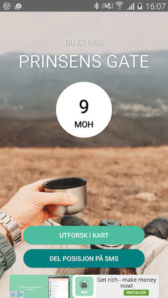
Above is a Norwegian-developed app that provides accurate altitude data for the entire country. Unlike other apps, Above uses the Norwegian Mapping Authority's terrain model, which provides precise elevation data from a grid of 10m x 10m.
You can also share your position via SMS, a useful feature if you are unsure of your location or simply want to remember the coordinates for a place at a later time.
The background map in Above is a unique combination of the Norwegian Mapping Authority's topographic map and mountain shadows. This makes it easier to see differences in the terrain.
All place names are taken from the Norwegian Mapping Authority's database (SSR). Background maps belong to the Norwegian Mapping Authority.
Keywords: altitude, meter above sea level, m.a.s.l, Norwegian, Norway, Norwegian Mapping Authority, elevation profile.